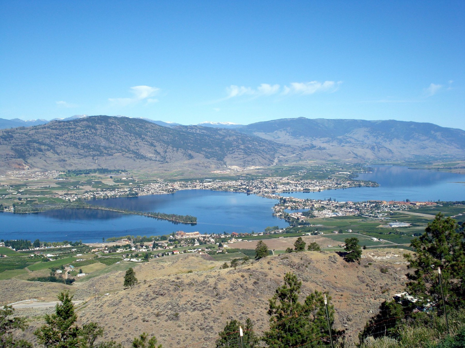
Into the Similkameen — where forests give way to dry hills, orchards, vineyards and one of Canada's most unexpected landscapes.
Princeton feels like a threshold.
Behind us are the forests and mountain lakes of Manning Provincial Park.
Ahead, Highway 3 begins following a landscape that looks increasingly different from the British Columbia we left behind on the Pacific coast.
The valleys become wider.
The slopes become drier.
Pine forest gives way to grassland and exposed rock.
Then something even more surprising appears.
Orchards.
Roadside fruit stands.
Vineyards.
And eventually, a long blue lake surrounded by dry hills.
This is the Similkameen Valley and South Okanagan.
And for many travellers, it is one of the most unexpected parts of British Columbia.
Leaving Princeton: Following the Similkameen
From Princeton, Highway 3 follows the Similkameen River east and south through an increasingly open valley.
The transformation that began after Manning Park now becomes impossible to miss.
The dense forests of the Cascades begin to thin.
Mountain slopes become more exposed.
The colours change from deep coastal greens to softer greens, golds and browns.
The sky seems larger.
This is not the British Columbia many first-time visitors imagine.
There is no ocean.
There are no Vancouver towers.
And this no longer feels like the wet mountain landscape around Hope.
We have entered the Southern Interior.
The Similkameen Valley
A Different Side of British Columbia
The Similkameen Valley is one of those places that makes a road trip worthwhile.
If you travelled directly between major cities, it would be easy to miss.
Driving Highway 3 makes the landscape part of the story.
The Similkameen River follows the valley.
Ranches and farms appear beside the road.
Dry hills rise above irrigated agricultural land.
And as we continue toward Keremeos, agriculture becomes increasingly visible.
The contrast is striking.
Brown and gold hills.
Green fields.
Fruit trees.
Vineyards.
A river running through it all.
This is a very different Canada from the one we left in Vancouver.
Keremeos
Where the Road Trip Starts to Taste Different
Keremeos does not need a major attraction to justify a stop.
The reason to stop is sitting beside the highway.
Fruit.
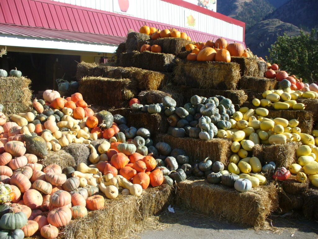
During the growing season, roadside stands display the produce of the Similkameen Valley.
Depending on the time of year, that can mean cherries, peaches, apples, nectarines, plums, tomatoes and other locally grown produce.
This is where the road trip becomes more than scenery.
You begin to experience the landscape through what it produces.
The dry climate, long growing season, irrigation and valley geography that shape the view around you also support orchards, farms and vineyards.
So stop.
Buy some fruit.
Talk to someone at a roadside market.
Put a bag of local cherries or peaches in the car.
Sometimes the most memorable souvenir from a road trip is something you eat before reaching the next town.
Orchards, Vineyards and Dry Hills
East and south of Keremeos, another element begins to appear more frequently:
vineyards.
This is where the journey begins transitioning toward the wine landscapes of the South Okanagan.
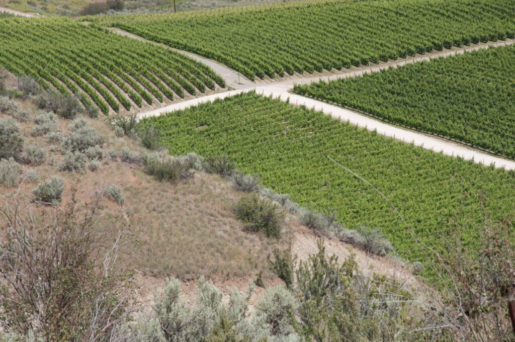
Rows of vines sit beneath dry hills.
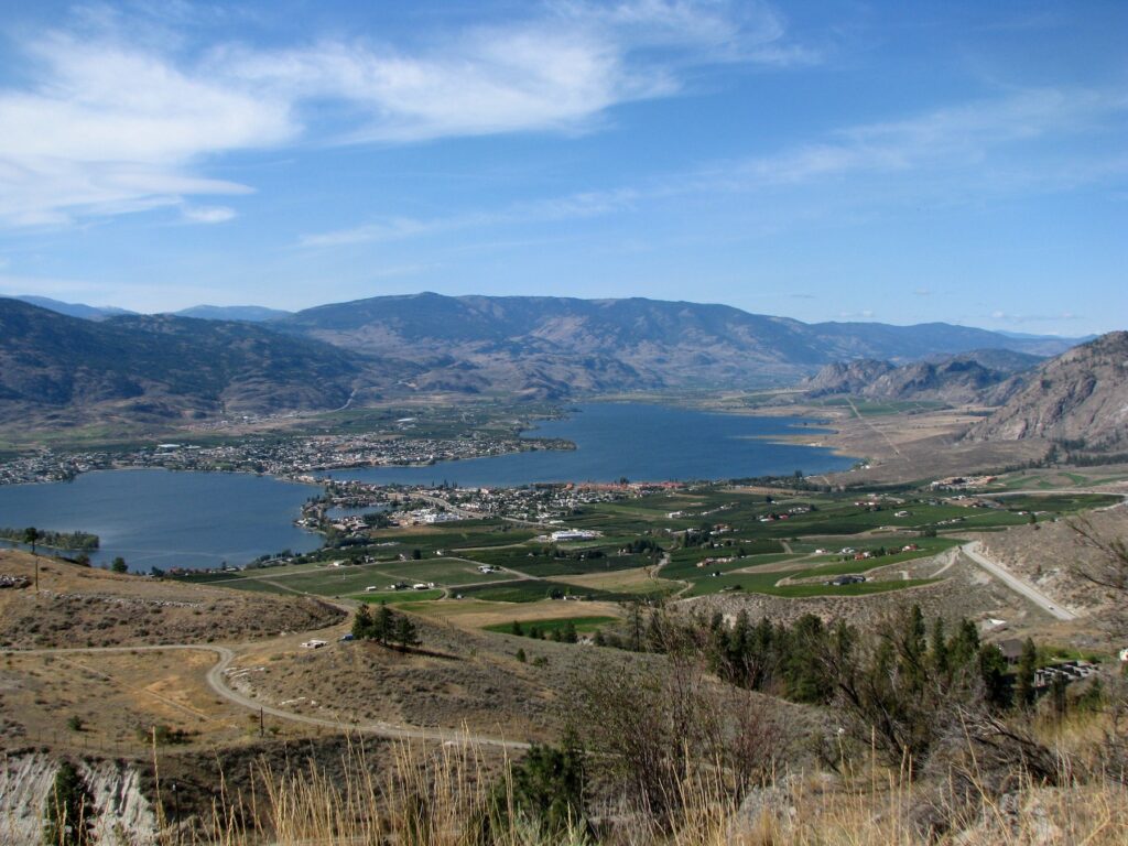
Orchards occupy green pockets in the valley.
The contrast between irrigated agriculture and the surrounding semi-arid landscape can be dramatic.
And once again, geography explains the experience.
We have travelled from the moisture of the Pacific coast, across mountain ranges and into the rain-shadowed Interior.
The change is written directly onto the land.
More Than a Scenic Drive
It would be easy to describe this section simply as:
Princeton → Keremeos → Osoyoos
But that misses the point.
The road is connecting different ways of life.
Princeton feels like an Interior mountain town.
The Similkameen becomes ranch and farm country.
Keremeos brings agriculture right to the roadside.
Then vineyards begin signalling what lies ahead.
The landscape is becoming warmer, drier and increasingly shaped by food and wine.
This is where From Pacific to Rockies becomes as much about lifestyle as scenery.
Approaching Osoyoos
As Highway 3 continues toward Osoyoos, the landscape becomes even drier.
Sagebrush and dry grass cover the slopes.
Rock is more exposed.
Trees become less dominant.
Then the road begins descending.
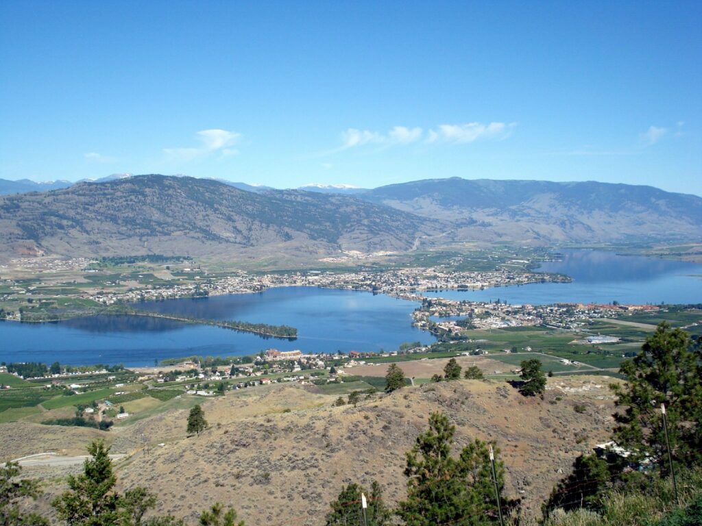
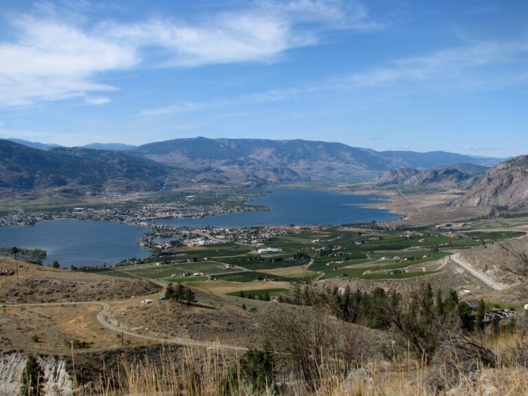
And below lies something that can seem almost out of place after the forests of Vancouver and Manning Park:
Osoyoos Lake.
Blue water surrounded by dry hills.
Agriculture and vineyards across the valley.
A town sitting beside the lake only a short distance from the United States border.
It is one of the strongest visual contrasts on our entire journey.
Osoyoos
A Canada Many Visitors Don’t Expect
Osoyoos is often described through its warm climate, lake and semi-arid environment.
But arriving by road gives the landscape additional meaning.
We have watched the change happen.
Vancouver gave us ocean and coastal forest.
The Fraser Valley gave us farms beneath green mountains.
Manning gave us alpine forest and mountain lakes.
Princeton introduced the Interior.
The Similkameen brought dry valleys, orchards and vineyards.
And now we arrive beside Osoyoos Lake.
The contrast is remarkable.
Slow Down Here
Osoyoos is not somewhere I would recommend treating as another quick highway stop.
This is where the rhythm of the journey should change.
Stay a night if your schedule allows.
Walk beside the lake.
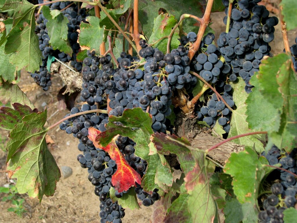
Visit a vineyard.
Have lunch somewhere overlooking the valley.
Swim, kayak or paddleboard when conditions and season permit.
And take some time to understand the landscape.
Because South Okanagan is not simply a warmer version of the rest of British Columbia.
It has its own ecology, agriculture, culture and identity.
The Land Has a Longer Story
The South Okanagan is also part of the traditional territory of the Syilx Okanagan people.
That matters.
A landscape should not be understood only through scenery, wineries or recreation.
The relationship between people and this land reaches far beyond modern tourism.
For visitors who want to understand more, the Nk'Mip Desert Cultural Centre near Osoyoos provides an opportunity to learn about Syilx culture, history and the ecology of this distinctive landscape.
It adds another dimension to the journey:
not simply looking at the land,
but beginning to understand it.
One Road, Another Canada
The transformation from Princeton to Osoyoos can be summarized in a few words:
Princeton
Pine forest · rivers · Interior mountain town
↓
Similkameen Valley
Open valley · ranches · dry hills
↓
Keremeos
Orchards · farms · roadside fruit
↓
South Okanagan
Vineyards · semi-arid landscape
↓
Osoyoos
Lake · dry hills · wine country
This is why we did not choose the fastest route.
The journey itself is showing us how many different landscapes can exist inside one province.
A Simple Princeton → Osoyoos Road-Trip Plan
| Section | Experience |
|---|---|
| Princeton → Similkameen Valley | River valley, ranch country and increasingly dry landscapes |
| Similkameen → Keremeos | Farms, orchards and the transition into fruit-growing country |
| Keremeos | Roadside fruit stands and local produce in season |
| Keremeos → Osoyoos | Vineyards, dry hills and increasingly semi-arid scenery |
| Osoyoos | Lake, food, wine, culture and outdoor activities; consider staying overnight |
Season note: Fruit stands, winery experiences and water activities are highly seasonal. Opening hours and availability should be checked before travelling; review current DriveBC conditions before departure.
Don’t Just Photograph the Landscape
This part of British Columbia rewards participation.
Buy the fruit.
Stop at the farm stand.
Taste something grown in the valley.
Walk beside the lake.
Learn about the people who have lived here for generations.
A road trip becomes memorable when places stop being backgrounds for photographs and start becoming experiences.
That is what happens in the Similkameen and Osoyoos.
Next Journey
Part 4 — Osoyoos to Kelowna
From Osoyoos, the road turns north.
And the character of the journey changes again.
The next section follows a chain of lakes, orchards, vineyards and communities through the heart of the Okanagan.
Oliver.
Penticton.
Skaha Lake.
Naramata.
Okanagan Lake.
And finally:
Kelowna.
This will be the lifestyle chapter of our Pacific-to-Rockies journey.
Less mountain crossing.
More lake country.
More food.
More wine.
And a reason to slow down for an entire day.
*Next: From Pacific to Rockies — Part 4: Osoyoos to Kelowna.***
FROM PACIFIC TO ROCKIES
Vancouver → Hope → Manning Park → Princeton → Keremeos → Osoyoos → Penticton → Naramata → Kelowna → Shuswap → Revelstoke → Golden → Yoho → Lake Louise → Banff → Canmore
Ocean. Valleys. Lakes. Vineyards. Mountains. One unforgettable journey.
Explore Canada. Remember the Journey.
Photo Credits and Licensing
All five photographs used in this article are original files or web-display derivatives. The immutable original files remain unchanged.
- Osoyoos from Anarchist Mountain Lookout.jpg — Photo: JamesZ_Flickr / Wikimedia Commons / CC BY 2.0. Resized and recompressed by BCgift to a maximum dimension of 1800 px for web display; no crop or compositional edits.
- Mariposa Fruit Stand – Keremeos, BC (6179691390).jpg — Photo: CK Golf / Wikimedia Commons / CC BY-SA 2.0. Original 1280×960 JPEG retained for web display; no content edits.
- Vineyards and Lake- Osoyoos in the Okanagan Valley.jpg — Photo: McKay Savage / Wikimedia Commons / CC BY 2.0. Resized and recompressed by BCgift to a maximum dimension of 1800 px for web display; no crop or compositional edits.
- Desert terrain among Osoyoos Vineyard.jpg — Photo: Jonathan Pope / Wikimedia Commons / CC BY 2.0. Resized and recompressed by BCgift to a maximum dimension of 1800 px for web display; no crop or compositional edits.
- Canada – BC – 11 – the lovely wineries of the Okanagan (4035535530).jpg — Photo: McKay Savage / Wikimedia Commons / CC BY 2.0. Resized and recompressed by BCgift to a maximum dimension of 1800 px for web display; no crop or compositional edits.

.jpg)


.jpg)